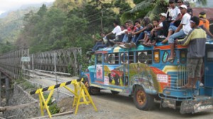
The lack of proper driving maps for northern Luzon, Philippines is one of several challenges in driving the island. Still, there’s much to see in the north, from the colonial architecture at Vigan to the spectacular rice terraces in the Bontoc and Banaue areas. This post will help you to avoid a tough road situation should you ever be traveling in that part of the Philippines.
I elected to begin my trip from Manila to northern Luzon by starting in the heritage town of Vigan, up in the northwest corner of the island. I did it because I wanted to start my trip as far from Manila as I could, backtrack through the Bontoc area, then head “home” to Manila. On every map I saw, there was what appeared to be a major road running east-west a little south of Vigan. The eastern terminus was near Bontoc, which mean that I wouldn’t have to drive south to Baguio, then northeast to Bontoc, which was (or so I thought) going to save me hours. It turns out the road is called the Bessang Pass, a gnarly pass with lots of extreme turns. The scenery is wonderful, but the road is slow. It crests at 4,563 feet, and there you’ll find a memorial to soldiers who died fighting on the Bessang Pass in WWII. As the plaque suggests, it was one of the toughest spots to take in the entire Pacific Theatre. As interesting as the pass was, I wasn’t making good time, so down the eastern side to the town of Cervantes.
And when I got to Cervantes, a few miles from the Bontoc road, I was told the bridge hadn’t been built yet, and my car wasn’t tall enough to ford the river. Unbelievably, although the road shows up as a main thoroughfare on a map, it lacks a bridge.
So instead, people at Cervantes told me to drive 20 kilometers south to the town of Mankayan, then drive west for a few kilometers to pick up the Bontoc road. The Mankayan road, it turned out, was half washed-out, half under construction, with few warning signs and sudden holes and pavement drops. It was barely good enough for 4 wheelers in some spots. It got pitch-black, and I decided to try to find a room and dinner in Mankayan, a small mountain town with a two-room lodge.
There, I was befriended by a police officer and highway worker, and they sorted me out for a 200 peso dinner and a 200 peso hotel room, a total of $10 USD. All in all, it ended up being a lovely experience meeting Senior Police Officer Anatolio Lapic and highway worker Darwin Limon. They proved that no matter how lost you are in the Philippines, you’re never alone.
And as far as that shortcut is concerned, forget about it unless you’re looking to add hours to your trip, and miles to your rugged overland vehicle. If you do desire this adventure, the western entrance to the pass isn’t all that well-marked from the highway. You’ll find it at GPS N16°5.076’ E120°26.922’

Leave a Reply